| Case Name |
The Great Meiji Sanriku Tsunami |
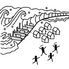
| Pictograph |
|
| Date |
June 15, 1896 |
| Place |
Sanriku coast of the Tohoku region, Japan |
| Location |
along the Sanriku coast |
| Overview |
After a strong earthquake with a magnitude of 8.5 occurred 150 km off the Sanriku coast, a huge tsunami struck the coast of Sanriku. The high tide and the rias shoreline magnified the tsunami. The highest wave reached 38.2 meters. The tsunami claimed 22,066 casualties and 8,891 homes. |
| Incident |
After the weak ground quake, a huge tsunami struck the coast of Sanriku. The highest wave reached 38.2 meters. The tsunami caused considerable damage, killing 22,066 people and destroying 8,891 houses. Photo 1 is the press photo of the catastrophic tsunami. |
| Sequence |
On June 15 1896 (Meiji 29), villages and towns were celebrating the return of the soldier who served in the Sino-Japanese War. That day was also the day of the Boys' Festival under the lunar calendar. At 7:30 pm, families were having dinner celebrating the Shinto holiday when they felt a little shock beneath their feet. The cost towns had several little shocks of earthquakes since March of the same year. There were numbers of strange phenomena reported in the area: dried up wells, low water level of wells, a large school of sardines off the coast and a large catch of tunas every day.
The towns had several little shocks on that day since the morning. Before the tsunami, a few felt a weak shock for 5 minutes and another one 10 minute later, but, no one was concerned too much about them because they caused no damage and the area had so many little earthquakes by then.
(The earthquake that caused the tsunami was actually a strong one with a magnitude of 8.5 occurred 150 km off the Sanriku coast. The earthquake of this type later got the nickname "nuru-nuru (slow and muddy) earthquake" in which the shock propagation is relatively moderated on the surface of the earth.)
At 8:07 pm, about 35 minutes after the weak earthquake, the first wave of the tsunami struck the Sanriku coast. About 3 minutes later at 8:15 pm, the second wave struck the coast, destroying houses that had withstood the first wave. The high tide and the rias shoreline of the Sanriku coast generated exceptionally high waves.
Some say that it was young seafood merchants who noticed abnormal tide in the sea when they were discharging ships. Following loud boom similar to distant roll of thunder, the sea abruptly withdrew away from the shore, listing ships and completely exposing undersea rocks, then rushed back onto the shore.
The highest tsunami wave reached an incredible height of 38.2 meters in the then Ryouri village of Miyagi. While victims in most tsunami disasters die by drowning, the Sanriku tsunami caused a large number of physical damages to its victims, leaving their remains heavily scarred. The monument to the Meiji Sanriku tsunami disaster in Ryouri describes the devastation, "In Ryouri, the victims were found with fractured skulls, broken legs or without arms". No one at that time had even imagined that a weak earthquake would cause such a strong tsunami. The same earthquake generated a tsunami in Hawaii. Its waves, 2.4 m - 9.1 m in height and caused considerable damage in the coastal area.
The tsunami waves swept the Sanriku coastline, taking 8,891 homes and 22,066 lives. |
| Cause |
The Sanriku coastline is especially tsunami-prone because of its complex topography. The Sanriku coastline is well known for its distinctive rias shoreline that consists of many long and narrow coastal inlets, which spreads out between the Same cape located east of Hachinohe in Aomori and the Ojika peninsula in Miyagi. Mountains lie close to the coastline. Towns and villages are located at coastal inlets between the long and narrow arms of peninsulas.
The offshore is one of the most earthquake-prone zones in the world. The shocks of an earthquake are propagated directly to the water in deep sea, and the pulse of displaced water in a tsunami wave extends all the way to the bottom of the ocean. Tsunami waves then travel across the ocean basin towards the shore, shortening wavelength and growing destructive. The saw-tooth Sanriku coastline faces the Pacific Ocean. As typically found in rias coasts, the depth and width of coastal inlets gradually and uniformly diminish inland. Once tsunami waves reaches the bay, their wavelength shrink as the sea becomes shallower towards the shore, and the tsunami grows destructive.
This Sanriku tsunami was exceptionally destructive because its tsunami-earthquake broke out at the time of high tide. Figure 2 shows the Sanriku coastline.
The heavy toll of lives was attributed to the fact that few noticed little shocks of the tsunami-earthquakes and those who noticed them were neither concerned about possible tsunami nor had the slightest idea to evacuate to an elevated inland location. |
| Response |
On June 16, the day following the tsunami disaster, a telegram reporting the disaster reached the Interior Ministry. After reporting to the Meiji Emperor, the Minister of the Interior Ministry contacted all Ministries to deliver relief and rescue for the tsunami victims. The Emperor delegated Chamberlain Viscount Motonaru Higashizono to visit the disaster site and cheer up the survived with encouraging words. The governmental agencies dispatched inspectors. The second division (Army) in Sendai sent the Army medic to the disaster site immediately after receiving the tsunami report. It also dispatched the military police soldiers to secure public order. Military engineers worked to recover bodies from the rubble. The Navy dispatched three warships to search the water and recover bodies of the victims. The Japanese Red Cross Society, the Fukushima Office of the Red Cross Society and the Nurse Association sent doctors and nurses to treat the injured. |
| Countermeasures |
The Sanriku tsunami generated no tsunami disasters prevention measures.
It was 37 years later in 1933 (Showa 8) when another strong tsunami struck the Sanriku coast, that the local governments played a central part in installing tide embankments, trees and escape roads. The local government also distributed a booklet describing precautions against the danger of tsunami so that the residents may participate in preventing a disaster.
The booklet calls the public's attention to the followings:
(Precautions)
- If weak earthquake shocks continue long, there may be a danger of tsunami waves. Watch any changes in the surroundings at least for an hour.
- Loud boom or rumbling sounds similar to distant rolls of thunder may be the sound of tsunami waves.
- Watch the tide as a tsunami causes the sea to abruptly withdraw away from the shore.
(Evacuations)
- Leave personal belongings behind and immediately evacuate to an elevated inland location.
- Sail far out to sea, if the ship on board is a few hundred meters off the shore. |
| Knowledge Comment |
One cannot rely on history of incidents too much to prevent earthquakes and tsunamis from claiming lives. The Sanriku tsunami proved that one must always take precautions to avoid the worst-case scenario.
All devastating disasters give us some kind of sign (small earthquakes in this case) before they happen. It is fascinating that Heinrich's Law applies to these cases as well. Although the method to predict an earthquake is yet to be found, tsunami forecast has been vastly developed since then. |
| Background |
Before the tsunami in 1896, the Sanriku coast already had a long history of tsunamis including the ones occurred in 1611 (Keicho 16), 1616 (Genna 2), 1651 (Keian 4), 1676 (Enpo 4), 1677 (Enpo 5), 1687 (Jokyo 4), 1689 (Genroku 2), 1696 (Genroku 9), 1716 through 1735 (Kyoho), 1781 through 1788 (Tenmei), 1835 (Tenpo 6), 1856 (Ansei 3), 1868 (Meiji 1), and 1894 (Meiji 27).
Past records report that the 1856 (Ansei 3) tsunami also caused devastating damage to the community. Similarly to this one in 1896, numbers of strange phenomena were reported right before the tsunami such as a large catch of tunas and sardines. |
| Sequel |
Until the Sanriku tsunami, there had been no record of tsunami generated by an earthquake that was felt week on land. The earthquakes that cause more damage by generating tsunami waves than shaking ground are now called "tsunami-earthquake". |
| Scenario |
| Primary Scenario
|
Unknown Cause, Occurrence of Abnormal Phenomenon, Non-Regular Movement, Movement During Transition, Failure, Large-Scale Damage, Bodily Harm, Death
|
|
| Sources |
Akira Yoshimura (1970) Umi-no Kabe (Ocean Walls), Chuokoron-Shinsha, Inc.
The General Insurance Association of Japan, Tsunami Bosai-o Kangaeru - Soozoo-shi Nikui Tsunami-no Jitsuzo (Preventing Tsunami Disasters - Revelation of Tsunami), The General Insurance Association of Japan.
Yotaro Hatamura (Editor), Jissai-no Sekkei (Practical Design) Research Foundation (1996) Zoku-Zoku Jissai-no Sekkei (Practical Design III), The Nikkan Kogyo Shimbun, LTD.
Fumio Yamashita (1995) Shashin-to E-de Miru (Photographs and Illustrations) - Great Meiji Sanriku Tsunami, Exhibition of Photographs and Illustrations of Meiji Sanriku Tsunami.
|
| Number of Deaths |
22066 |
| Physical Damage |
Houses destroyed; 8,891 |
| Multimedia Files |
Photo1.Devastated region: Omori district, Shizugawa, Miyagi
|
|
Figure 1.Devastated region: Kamaishi, Iwate
|
|
Figure 2.Local Death Tolls and Wave Heights of Meiji Sanriku Tsunami
|
| Field |
Mechanical Engineering
|
| Author |
NAKAO, Masayuki (Institute of Engineering Innovation, School of Engineering, The University of Tokyo)
|
|