| Case Name |
Eruption of Mount Usu |
| Pictograph |
|
| Date |
March 31, 2000 |
| Place |
Hokkaido, Japan |
| Location |
Mt. Usu |
| Overview |
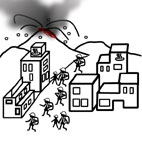
On March 27, 2000, volcanic activity and the number of earthquakes started to show an increase around Mount Usu located on the Northern Japanese island of Hokkaido. Some fault lines were found in the western side of Mt. Usu. At 13:07 on March 31, the western flank of the mountain erupted for the first time in 23 years, sending white smoke and ash over a large area including the towns of Abuta, Soubetsu, Otaki and the cities of Tomakomai and Chitose (Figure 1). The second eruption from Mt. Kompira spewed hot rock and steaming mud towards the hot spring resort towns, swallowing bridges nearby.
Experts say that Mt. Usu erupted because a lava dome located 10 km below the surface grew as a deeper core eruption spewed lava into it.
Despite the threat of powerful volcanic activity, there were no injuries or fatalities. It was largely due to effective crisis management, which enabled quick circulation of information, cooperation of agencies, preparation of a hazard map, and safety consciousness of residents. As a result, 234 homes were destroyed and 217 homes were damaged. The overall damage amounted to 10.3 billion yen. Photo 1 shows the first eruption of Mt. Usu. |
| Incident |
On March 27, 2000, volcanic temblor and activity and the number of earthquakes started to show an increase around Mt. Usu located on the Northern Japanese island of Hokkaido. Some fault lines were found in the western side of Mt. Usu. At 13:07 on March 31, the western flank of the mountain erupted for the first time in 23 years, sending white smoke and ash over a large area including the towns of Abuta, Soubetsu, Otaki and the cities of Tomakomai and Chitose (Figure 1). The second eruption from Mt. Kompira spewed hot rock and steaming mud towards the hot spring resort towns, swallowing bridges nearby.
Despite the threat of powerful volcanic activity, there have not been any injuries or fatalities.
As a result, 234 homes were destroyed and 217 homes were damaged. The overall damage amounted to 10.3 billion yen. Photo 1 shows the first eruption of Mt. Usu. |
| Sequence |
On March 27, the Muroran Local Meteorological Observatory and the Usu Volcano Observatory of Hokkaido University obtained readings of three earthquake activities near Mt. Usu by noon. The frequency of earthquakes increased every hour. The number of earthquakes in an hour almost multiplied to 7, 13, 24, and 42 tremors starting at 19:00 on the same day. There were total 109 earthquakes on that day (normally 20 to 30 a month).
On March 28, out of 590 volcanic earthquakes, 69 were noticeable to the residents of nearby towns.
On March 29, volcanic activity intensified around Mt. Usu. The area had 1,628 tremors including the ones of magnitude 3.4 and 3.5 occurred at 7:08 and 9:42 respectively, in which 628 were noticeable to the residents.
On March 30, Japan Ground Self-Defense Force sent a helicopter to the site just above the hypocenter of volcanic earthquakes, and experts including Professor Okada, director of the Usu Volcano Observatory of Hokkaido University (located in the mountainside of the Sobetsu hot spring resort) observed new chains of cracks as long as 100 meters in the northwestern part of the caldera rim (at the west ridge of the north Byobu mountain). New fault lines were also found in front of Toya Kyokai Clinic in the hot spring resort town of Lake Toya as well as near the hot spring resort town of Sobetsu. The daily volcanic earthquakes had increased to 2,454, in which 537 were noticeable to the residents.
On March 31, the volcano erupted at 13:07 after two decades of silence, spewing a plume of ash and smoke over the surrounding areas. At 14:00, a plume of ash rose over 3,200 meters into the sky from the crater located at the western part of the summit, and was carried east-northeast by the wind. Although the emission of ash and cinders declined to 800 meters in height as the eruption declined about 2 hours later at around 15:00, volcanic ash reached a large area including the towns of Abuta, Soubetsu, Otaki and the cities of Tomakomai and Chitose.
In the early morning at 3:12 on April 1, while the largest tremors of magnitude 4.8 (5.0 in Sobetsu), were jolting the area, another eruption occurred near the Route 230 in the flank of Mount Konpira located at northwest of the craters that erupted on the previous day. The third eruption occurred at 11:50 about 350 meters south of the hot spring resort town of Lake Toya, which was 600 meters east of the craters that had already erupted.
On April 2, the eruption activity continued at Mt. Konpira. Hot rock, gas and a plume of ash and smoke billowed over the towns nearby. The steaming mud flowed down the mountain towards the hot spring resort town of Lake Toya.
On April 9, the steaming mud flowed over a landslide prevention barrier at the Nishiyama River channel and into a drain that runs through the resort area.
On April 10, the steaming mud washed away two bridges at the Nishiyama River.
As seismic activity near the volcano began to increase, approximately 16,000 residents of the Usu communities of Date, Sobetsu and Abuta moved to evacuation centers, where people stayed for 5 days at least and 5 months at most. |
| Cause |
The eruptions of Mt. Usu were most likely caused by subsurface magma movements. A lava dome located 10 km below Mt. Usu grew as a deeper core eruption spewed lava into it. Volcanic earthquakes took place as the magma in the lava dome sought surface vents and broke bedrocks (precursors to a volcanic eruption). Magnitude of earthquakes became stronger as the magmas ascended to the surface. Cracks occur on the fragile parts of the bedrocks as magmas ascended to a depth of 2 to 3 km. Magmas then passed through the aquifers located 100 meters below the surface, causing violent water-assisted explosions that spewed fragmented magmas.
Figure 2 (1) through (6) illustrate the steps from outbreak to end of the eruptions.
Despite the massive steam explosions, there were no injuries or fatalities. In the next section, we will see in details on the crisis management taken during the volcanic activity. |
| Response |
At 0:50 on March 28, the Muroran Local Meteorological Observatory issued the first special bulletin reporting "Earthquake activities increased near Mt. Usu. The focal area of noticeable tremors was near Mt. Usu". At 11:00, a press conference was held at the Sobetsu town office, and Professor Hiromu Okada of Hokkaido University reported a possible volcanic earthquake in a near future. At 11:50, Yoshiaki Iida, the chairman of the Coordinating Committee for Prediction of Volcanic Eruptions (Japan Meteorological Agency) warned the public of a possible volcanic eruption. Officials issued a voluntary evacuation advisory to certain areas of the towns of Date, Abuta and Sobetsu. About 400 residents were evacuated.
At 11:10 on March 29, the Muroran Local Meteorological Observatory issued the first emergency volcanic alert alarming the public of the increasing frequency of earthquakes as a signal of an imminent eruption. At 18:15, Professor Okada had a press conference and reported an increased likelihood of an eruption from the northwest flank of Mt. Usu in the next few days, if not definitely in a week. Officials issued an evacuation advisory, which was soon raised to an evacuation directive at 18:30, to the towns of Date, Abuta and Sobetsu. About 9,500 residents left their homes. (Out of 1,628 tremors on that day, 628 were noticeable to the residents.)
At 10:00 on March 30, the Mt. Usu Field Liaison and Coordination Committee studied the hazard map (Figure 3).
At 3:20, the Muroran Local Meteorological Observatory issued the second emergency volcanic alert alarming the public of the new chains of cracks as long as 100 meters in the northwestern part of the caldera rim (at the west ridge of the north Byobu mountain). Officials issued an evacuation directive to residents (475 households and 1,319 residents total) of Tsukiura, Irie and Takasago in the town of Hikita. (The daily volcanic earthquakes had increased to 2,454, in which 537 were noticeable to the residents.)
At 13:07 on March 31, the volcano erupted from the western flank of the mountain for the first time in 23 years.
At 14:00, a cabinet meeting was held in the office of the Prime Minister to support the setting up of two emergency centers, the Mount Usu Eruption Emergency Center and the Field Emergency Center (at Date City Hall). Officials issued an evacuation directive to all areas of the town of Hikita except Shimizu and Hanawa. (The evacuated reached 15,815 in total.)
On April 1, another eruption occurred in the flank of Mount Konpira.
On April 2, the eruption activity continued at Mt. Konpira spewing hot rock, steaming mud, a plume of ash and smoke. The steaming mud flowed down the mountain towards the hot spring resort town of Lake Toya. Officials lifted the evacuation order for selected areas (total 123 households and 375 residents) in the city of Date. Among the Abuta residents staying at the Toyoura shelters, 2,000 were relocated to shelters in the towns of Osyamanbe and Toya.
On April 5, the Coordinating Committee for Prediction of Volcanic Eruptions of Mt. Usu (Japan Meteorological Agency) rePORT 68,166,190,246,130,116
eruption could occur within the couple of days, if not within the next two weeks.
On July 10, the Coordinating Committee for Prediction of Volcanic Eruptions and experts reported that the lava dome located below the volcano stopped growing and underground magma activity began to subside. Two of the hotels in the hot spring resort town of Lake Toya were reopened.
On July 13, the Mt. Usu cable car started its normal operation.
On August 8, the Hokkaido government proposed to zone the areas near Mt. Utu into 4 at the meeting of various project managers in municipality of the vicinity of Mt. Usu (Mt. Usu syuhen kankei chi-cyo kikaku kacyo kaigi).
On August 10, the Coordinating Committee for Prediction of Volcanic Eruptions of Mt. Usu reported that tectonic activity subsided near the western flank of the mountain.
On August 11, officials closed the Mount Usu Eruption Field Emergency Center.
On December 28, the Hokkaido government announced its plan for reconstruction of the areas affected by volcanic activity.
On May 28, 2001, the Coordinating Committee for Prediction of Volcanic Eruptions reported that underground magma activity has subsided, and closed its Mt. Usu subcommittee. |
| Countermeasures |
In late June 2000, the Hokkaido government had working-level talks with three local agencies to plan reconstruction of local communities affected by volcanic activity. After studying the report created in 1980 by Hokkaido and its project team of volcano and torrent control experts, officials discussed zoning of residential and business in a town/city (Professor Okada explains that the report was submitted 3 years after the 1977 eruption, which was too late to be used for reconstruction efforts. He also remembers that the suggestions made in the report were not implemented because local agencies were not involved in the project). While tourist-related businesses remain in the current hot spring resort areas, cities and towns encourage residential homes and public facilities such as schools to locate in safer areas by enforcing zoning regulations. In addition to zoning, Professor Tadahide Ui of Hokkaido University suggested to convert an affected area into an eruption memorial park by preserving some standing bridges and homes in the area. Such a park can be used to educate the public and students on school trips about the threat of volcanic activity. It can also work as a torrent control structure in case of a mudflow.
On July 23, the city of Date and the towns of Abuta and Sobetsu announced their plans for reconstruction of the areas affected by volcanic activity, in which zoning would be implemented to encourage relocation of housing communities to areas safe from the threat of future eruptions. Officials emphasized that their reconstruction plans would set an example for development of communities nationwide.
Figure 4 and 5 show the zoning plan and the zoning map.
The hazard map of Mt. Usu, which proved its usefulness during evacuations in the 2000 eruptions, was updated and distributed in 2002. |
| Knowledge Comment |
An effective communication system is essential for efficient and quick evacuation of residents.
Disaster prevention requires people's cooperation and understanding on disaster through evacuation drills and education.
Professor Okada pointed out in his research paper, which was published before the 2000 Mt. Usu eruption, that scientists, officials and mass media could assist people by collaborating closely to assure safety of community. This attitude (in his words, the scheme "mitigation tetrahedron relation") works for all types of disasters and accidents.
Also the important is a swift development of reconstruction plan after a disaster. As the proverb says, "Strike the iron while it is hot". Otherwise, a plan becomes difficult to execute. |
| Background |
Mt. Usu is said to have 100,000-year long history of volcanic activity. A caldera was formed about 100,000 yeas ago when a large eruption emptied the magma chamber beneath the volcano. The island at the center of the water-filled caldera was formed as the result of a series of eruptions occurred about 40,000 years ago. The current stratovolcano was formed as many eruptions occurred in the southern part of the caldera rim about 20,000 years ago. The current shape of the southwestern frank was formed about 7,000 years ago. The next eruption of Mt. Usu was in 1663, for the first time in 7,000 years. Since then, there were 8 eruptions, once in every 20 to 50 years. All 8 activities continued for 1 to 2 years before Mt. Usu rested again for decades.
All eruptions in the past accompanied noticeable precursors, which lasted 3 to 10 days. The longest term of precursors was 6 months recorded in the 1944 eruption, and the shortest term was 32 hours recorded in the 1977 eruption, which killed 3 people in mudflows. |
| Incidental Discussion |
The significant outcome from the 2000 Mt. Usu eruption was the effectiveness of the crisis management, which was credited for quick action and evacuation of 16,000 people. Experts provided accurate predictions of Mt. Usu eruptions, saving lives of residents.
Mt. Usu had a long history of volcanic activity, which enabled experts to study the characteristics of its subsurface magma activity. Also, Mt. Usu did not "betray the expert predictions" as Professor Okada says, and it had many observation sites already set up. Another factor that contributed the zero-casualties was the hazard map. Based on the damages caused by the past eruptions, officials had created a hazard map that showed areas potentially threatened by an eruption, and distributed a copy of it to every home in the communities near Mt. Usu. Note that a hazard map itself does not help saving lives. It must be utilized to effectively warn the public of a volcanic eruption a lot earlier than it actually occurs. For example, the 1985 eruption of the Nevado del Ruiz volcano in Colombia caused devastating damages (devastated the town of Armero and killed 20,000 people) as predicted by the hazard map. Although a preliminary hazard map for Ruiz was completed one month before the 1985 eruption, it was not adequately utilized to save the lives lost when the mudflows struck.
The cases illustrate the difference in transferring information of the continually changing situations.
The Usu Volcano Observatory of Hokkaido University (Professor Okada, director) provided information to two independent agencies that had responsibility in different crisis-management duties: the Sapporo District Meteorological Observatory that issues official volcanic information, and the Hokkaido government that determines necessary emergency measures. While a meteorological observatory was responsible for observation and disclosure of volcanic activity, the Fire and Disaster Prevention Division of the Hokkaido government was responsible for issuance of evacuation advisories and directives. In addition to these two agencies, the Usu Volcano Observatory of Hokkaido University had press conferences to explain the ongoing volcanic activity in a timely manner to the public. This communication system was proven effective in providing accurate information in time to minimize damages. As a social psychologist said, "warning is effective for saving lives, if the hazardous situation is presented in an easy-to-understand manner to the people in crisis".
Learned from the Mt. Unzen eruption in the past, officials had been emphasizing the importance of the hazard map and encouraging the local residents to study it thoroughly just in case of Mt. Usu eruption. The fact that the residents all knew about the Mt. Usu hazard map made a quick evacuation possible.
Officials all placed maximum priority on human life. Mayors of cities and towns made efforts to persuade residents to evacuate officially through emergency bulletins as well as unofficially through interviews taken by mass media. After the first eruption of Mt. Usu, the Cabinet Security Affairs and Crisis Management Office ordered railways to provide extra service for evacuation of residents (railways suspended express services at the Osyamanbe Station and brought the railcars to Toya). Compare to the evacuation efforts in the 1995 Great Hanshin-Awaji Earthquake, officials and agencies showed a vast improvement in crisis management. |
| Scenario |
| Primary Scenario
|
Unknown Cause, Occurrence of Abnormal Phenomenon, Non-Regular Movement, Movement During Transition, Failure, Large-Scale Damage
|
|
| Sources |
The Hokkaido Shimbun Press (Editor) (2002) 2000-Nen Usu-Zan Funka (The 2000 Mt. Usu Eruption), The Hokkaido Shimbun Press.
|
| Physical Damage |
234houses destroyed, damaged 217 |
| Financial Cost |
10300000000 |
| Multimedia Files |
Photo 1.Mount Usu Eruption with Pyroclastic Flows, the First Time in 23 Years
|
|
Figure 1.Outbreak to end of eruption
|
|
Figure 2.Outbreak to end of eruption
|
|
Figure 3.Hazard Map of Mt. Usu, Modified after 2000 Eruption
|
|
Figure 4.Zoning Adopted by Reconstruction Plan after the 2000 Mt. Usu Eruption
|
|
Figure 5.Zoning Map Adopted by Reconstruction Plan after the 2000 Mt. Usu Eruption
|
| Field |
Mechanical Engineering
|
| Author |
NAKAO, Masayuki (Institute of Engineering Innovation, School of Engineering, The University of Tokyo)
|
|